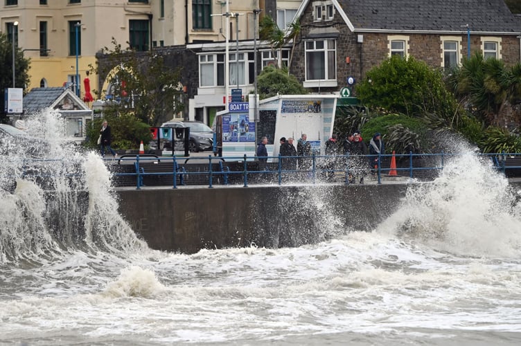
All Pembrokeshire Council facilities - leisure centres, parkland, libraries, waste and recycling centres will be closed on Saturday, December 7, with a rare Red ‘danger to life’ weather warning for very strong winds issued, with Storm Darragh due to hit.
Bus services will also be suspended and Transport for Wales has been advised.
Plans are in place by PCC to respond to impacts on the highways network and the community with additional staff on standby if needed.
There is likely to be closure to high sided vehicles on the Cleddau Bridge with potential for full closure in place during the night and throughout Saturday.
The emergency night shelter protocol has been triggered and the centre will be open until Monday (December 9).
Arrangements have been put in place with care providers and care homes to support our most vulnerable members of the community.
The Met Office has issued a rare Red warning for very strong high winds affecting North, West and South Wales from 3am to 11am on Saturday (December 7).
Natural Resources Wales have also issued Amber warnings for risk of flooding in parts of Wales, including those affected by Storm Bert.
A Yellow warning for wind has been issued by the Met Office for the counties from 3pm today (Friday, December 6).
Natural Resources Wales have also issued a flood alerts for parts of Pembrokeshire.
“Flooding of low-lying land and roads is expected. Rainfall is currently affecting this area. River Levels are above normal levels,” state NRW.
“Due to restrictions at the tidal outfall, river levels in the River Ritec in the Salterns area of Tenby are likely to remain high for a number of days. You may notice river levels rising slightly as each high tide arrives. We will continue to monitor the situation.”
What to expect:
- Danger to life due to flying debris and falling trees
- Large waves and beach material being thrown onto coastal roads, sea fronts and homes
- Power cuts affecting other services, such as mobile phone coverage
- Damage to buildings and homes, with roofs blown off and power lines brought down
- Roads, bridges and railway lines closed, with delays and cancellations to bus, train, ferry services and flights
It will turn increasingly wet and windy as Storm Darragh arrives through Friday afternoon and evening. Maximum temperature 10 °C.
Friday night will see outbreaks of rain, heavy at times will move east overnight, as winds continue to strengthen with gales and later severe gales develop near coasts, as Storm Darragh arrives. Mild Minimum temperature 5 °C.
On Saturday, heavy rain continues throughout the day, though easing into the evening. Strong winds continue, particularly along the coasts. Maximum temperature 10 °C.
It will be turning colder on Sunday with showers and blustery winds gradually easing. Monday could see the odd shower but overall, a much more settled day. Tuesday will be dry and bright.
The Met Office forecast gusts that will frequently reach 60 to 70 mph and, along exposed coastal stretches 70 to 80 mph is possible at times, with 20 to 30mm of rainfall expected quite widely.
Some parts of Wales likely to see 50 to 60 mm over this period which may lead to some flooding and disruption in places.
Residents and visitors are advised to be safe and not make unnecessary journeys during the weather warnings.
The public are reminded to be careful whilst travelling as the winds may result in fallen trees and debris being present on the highway.
The public are also asked to be vigilant in relation to the potential damage to buildings and other structures, resulting in tiles and other debris falling in public areas.
The winds could also lead to power cuts and affect council-run services.
The Deputy First Minister said: “Red warnings are issued when there is a potential threat to life, and therefore it is essential that people in Wales heed the warnings and take very great care if they are travelling on Saturday.
“Welsh local authorities, emergency services and Natural Resources Wales have activated their preparedness structures in readiness for Storm Darragh. I urge people to make sure they are aware of the warning levels for their local area and to follow all official advice.
“We will be monitoring the situation closely and providing any support required to the agencies in their response.”


